

When catastrophic flooding tore through the China-Nepal Himalayan border region in August 2026, international coverage quickly settled on a familiar description: the Nepal floods. Although… the whole incident happened deep inside Chinese borders, and the landslide cascaded downstream all the way to India.
Nepal suffered most of the reported deaths, and most independent photographs, survivor accounts and official information available to foreign journalists came from Nepal. That is a bias because China has a big filter before any news is reported. China first reported laughable casulaties – then slightly less ridiculous figures. At the time of this article, they’re reporting 17 deaths on their side of the border.
In a sample of 11 major English-language news headlines covering the disaster, only two explicitly used the country name China.
| Headline framing | Share |
|---|---|
| Nepal without China/Tibet | 55% |
| Nepal + Tibet | 27% |
| Explicitly mentions China | 18% |
| Does not mention China | 82% |
Calling the Chinese side “Tibet” is geographically valid. But it has an unusual effect: Nepal appears as a country while China disappears behind the name of one of its regions.
That matters because this story is not only about where people died. It is also about who controlled the upstream territory, who had the first opportunity to observe the danger, and who was responsible for passing information downstream.
The warning from 2025 was already unmistakable
One year earlier, on July 8, 2025, another destructive flood came down this same corridor.
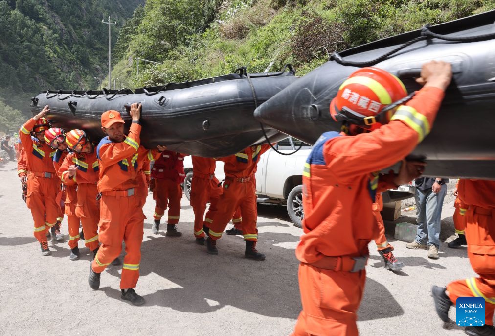
Drills -for show- and the 2026 rescue “efforts” with spotless rescue uniforms doing useless tasks – that’s SO CHINA if you know, you know. I got used to seeing this display in the floods all through the years showing rescue workers eating in the rain or in the flood walking with ankle-deep water…
That event has none of the geographical ambiguity now surrounding the precise location of the 2026 initial mountain collapse.
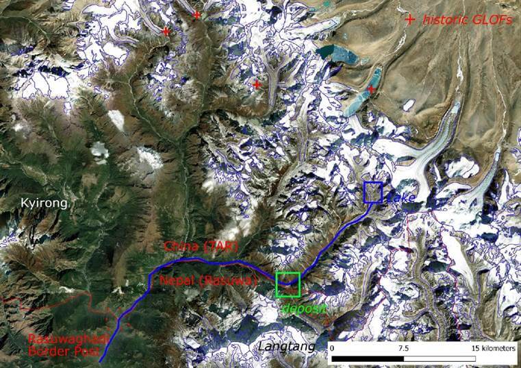
The source was a rapidly expanding supraglacial lake on Purepu Glacier in Tibet, China.
Nepal’s National Disaster Risk Reduction and Management Authority placed the lake approximately 35 kilometres upstream of the Nepal-China border. Using published coordinates, it was about 30 kilometres inside China in a straight line.
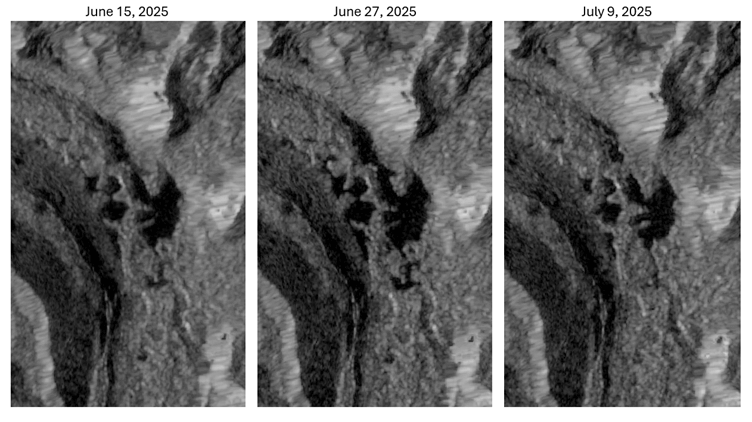
Satellite observations later showed that ponds had been developing there for months before the failure and expanding rapidly shortly before the lake burst.
Researchers subsequently concluded that the Purepu lakes were not being actively monitored.
Nepal received no advance warning.
That should have changed everything.
The upstream hazard was in Chinese territory. Nepal could not install instruments around it, inspect it independently or operate monitoring stations inside Tibet. For information about that danger, Nepal was necessarily dependent on China.
China “prepared”. Then the real warning still failed.
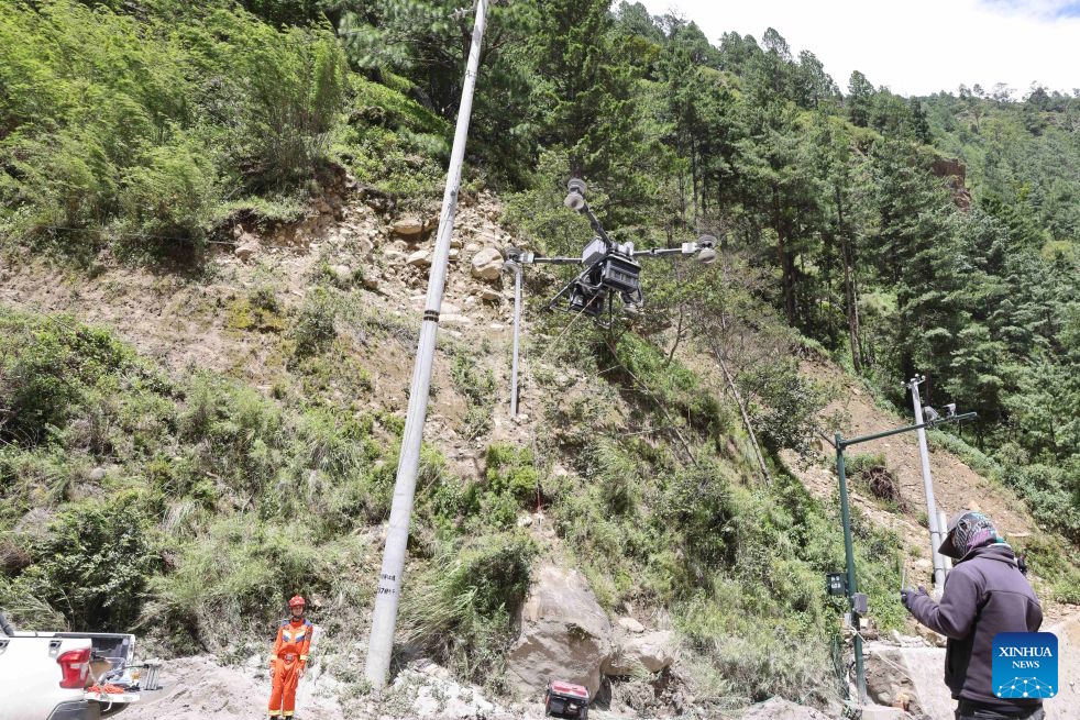
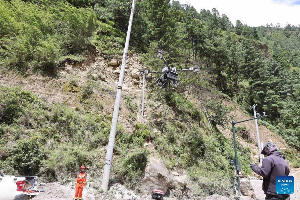
After the 2025 disaster, Chinese authorities did respond. Showing off drones doing useless tasks and clean orange uniforms standing around is the norm. But in theory they said everything was safe. In my opinion, to reassure tourism commerce, without actual steps being taken. The typical facade.
Emergency plans were updated. Flood defenses were built. Water levels were monitored. Officials received glacial-flood training. Residents even participated in evacuation exercises using loudspeakers, WeChat and door-to-door warnings.
Meanwhile, Nepal continued asking China for better upstream information.
As recently as May 27, 2026, officials from the two countries met to discuss glacier monitoring, water conditions, hazard mapping and data sharing. Reuters reported that Nepal wanted more information about upstream glacier movement and water levels, while Chinese representatives said they lacked authority to conclude the requested agreement.
Three months later, disaster struck again.
China says it shared information with Nepal in a timely manner.
But that claim raises a very simple question: At what time?
Reuters reconstructed the morning of August 26 using surveillance footage and interviews.
At about 8:32 a.m. Nepal time, CCTV at the Tibetan border crossing showed a massive torrent destroying infrastructure.
At that point the danger was no longer theoretical. Chinese cameras could visibly see a catastrophic flow moving through the border region, and the river continued downstream toward Nepal.
Yet it was not until approximately 8:58 a.m., 26 minutes later, that Nepalese hydrologist Binod Parajuli was contacted by Nepal’s own disaster authority about flooding on the Trishuli.
Nepal’s monitoring stations had begun disappearing, apparently destroyed by the flood itself.
Nepal then independently tried to determine what was happening and issued a mobile warning at approximately 9:13 a.m.
That is roughly 41 minutes after the catastrophe was visible on CCTV in Tibet.
There may have been communications from China during this interval. If so, they should be easy to document.
China should publish the timestamp.
When did Chinese authorities recognize that a catastrophic flood was heading downstream?
When did they notify Nepal?
Which agency sent the message?
Who received it?
And what did the warning actually say?
Without those answers, saying that information was shared “in a timely manner” is not evidence. It is a government claim.
Upstream and downstream are not equal responsibilities
Nepal’s warning network also failed.
Several river gauges stopped transmitting or were destroyed. A warning system should have redundant sensors, independent communications and instruments positioned so that the disaster being monitored cannot simply destroy the monitoring network.
But that does not make the responsibilities equal.
Nepal was downstream.
China controlled much of the upstream territory, had substantially greater technical resources and had direct access to information Nepal could not independently obtain.
Most importantly, once the torrent reached Gyirong, Chinese authorities had something no downstream sensor was required to infer:
they could see it.
An upstream country cannot prevent every avalanche or glacier collapse.
But when an enormous destructive flow is already visible and heading toward another country, passing that warning downstream is one of the most basic functions of a transboundary disaster system.
Why did the world mostly hear a Nepal story?
There is another asymmetry that helps explain the 82%. Information coming from Nepal was comparatively accessible. Journalists could speak with survivors, rescue workers, local officials and scientists. Photographs and videos circulated freely.
Tibet is different: Foreign journalists face severe restrictions on independent travel and reporting there, while China’s internet and domestic media operate under extensive government control. The Guardian noted after the flood that information restrictions made independent assessment of destruction inside Tibet much more difficult.
That produces an important distortion: More accessible reporting comes from Nepal. More images come from Nepal. More interviews come from Nepal. Search results consequently become dominated by Nepal.
Eventually a cross-border upstream-to-downstream disaster becomes known simply as a “Nepal flood.”
The geography of available information begins replacing the geography of the actual event.
Even ChatGPT fell into the same trap
While researching this article, I asked ChatGPT running GPT-5.6 Sol with high reasoning where the 2026 initiating collapse occurred.
Its first answer was surprisingly confident:
“The best current evidence places the August 26, 2026 collapse on the Nepal side of the border.”
But when the underlying sources and maps were examined more closely, there was no such clear consensus.
Reuters’ detailed terrain reconstruction labels the glacier from which the collapse began as being in China. Al Jazeera described the avalanche entering the Lhende River in Tibet.
USGS and Chinese government accounts instead placed the initiating failure on the Nepalese side.
In other words, the evidence was disputed. Yet the AI had transformed that disagreement into confidence that Nepal was the accepted location. That is an interesting example of how information bias can reproduce itself without anyone explicitly programming a political conclusion.
If the overwhelming majority of searchable stories say “Nepal floods,” if most reporting comes from Nepal, and if authoritative pages repeatedly attach “Nepal” to the disaster, an automated system can begin treating frequency of framing as evidence of geography.
After being challenged, ChatGPT corrected the answer, but the first answer was revealing.
The real question is not whether China “caused” the flood
Natural disasters do not respect borders, and nobody needs to claim that China caused a glacier collapse to examine responsibility here. Although they’ve shown construction and mining activities in the area – which suggests they should have secured the area.
A dangerous upstream corridor had already produced a deadly China-origin flood in 2025. The lake responsible had not been actively monitored.
Nepal received no advance warning. Scientists warned about the corridor. China introduced monitoring and evacuation exercises. Nepal asked repeatedly for better upstream information.
Then another catastrophe struck. Chinese CCTV visibly recorded the torrent at the border. Nepal still had to determine what was happening after its own downstream instruments began failing.
That is the accountability issue.
The upstream state had the territory, the monitoring advantage, the cameras and far greater technical capacity. So before this disaster is permanently reduced to another entry under “Nepal floods,” there is one question Beijing should answer clearly:
When exactly did China warn Nepal?
Sources
Reuters — China-Nepal warning and data-sharing investigation
https://www.reuters.com/business/environment/before-flood-catastrophe-nepal-asked-china-early-warnings-risks-mounted-2026-08-30/
Reuters — 2026 collapse and flood reconstruction
https://www.reuters.com/world/asia-pacific/how-glacier-collapse-triggered-deadly-landslide-flooding-along-nepal-china-2026-08-27/
Nepal NDRRMA — official report on the 2025 Purepu Glacier flood
https://ndrrma.gov.np/mediafiles/publications/Rasuwagadhi_Flood_Sitrep1_08072025_.pdf
HiRISK — Purepu Glacier GLOF assessment and coordinates
https://hirisk.org/wp-content/uploads/2025/07/RHA_CN1_PurepuGLOF-2.pdf
Stimson Center — Purepu monitoring failure and China-Nepal glacial hazards
https://www.stimson.org/2025/investigating-an-emerging-climate-hazard-transboundary-glacial-floods-on-the-china-nepal-border/
Kathmandu Post — lack of advance warning from China after the 2025 flood
https://kathmandupost.com/climate-environment/2025/07/09/rasuwagadhi-flooding-exposes-gaps-in-neighbourly-data-sharing
Guardian — restrictions on independent reporting from Tibet
https://www.theguardian.com/world/2026/aug/28/chinese-controls-information-hamper-assessment-tibet-flood-damage
Freedom House — internet and information controls in China
https://freedomhouse.org/country/china/freedom-net/2025
Al Jazeera — satellite analysis of the 2026 disaster
https://www.aljazeera.com/news/2026/8/27/satellite-images-show-destruction-from-nepal-tibet-floods


 EN
EN  FR
FR